PMlogo2
item4a item4a1
item4a History.. item4a item4a2b
item4a2b History.. item4a2b item4a1 Contact.. item4a1
item4a1
item4a2b
item4a2b History.. item4a2b item4a1 Contact.. item4a1
item4a item4a2b item4a1
item2
item2 item2 item2
item2 New schematic maps of the item2
item2
item2
item2
Network outline   Network outline   Network outline
1
2
3
Network outline
4
East Anglia train rail map East Anglia train rail map
East Anglia train rail map East Anglia train rail map East Anglia train rail map East Anglia train rail map East Anglia train rail map East Anglia train rail map
East Anglia train rail map
East Anglia train rail map East Anglia train rail map East Anglia train rail map
Map 1 uses 22.5º on a square design.
Much more design effort has been put into map 2 to soften curves, enlarge the London suburbs, increase the point size and fill the space. My favourite of the three.
It looks like my point size is smaller than that on the map by One above right - I usually aim to beat the point size of other maps - but I have got larger main stations!
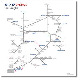
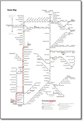
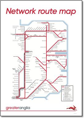
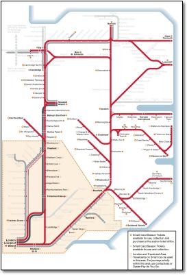
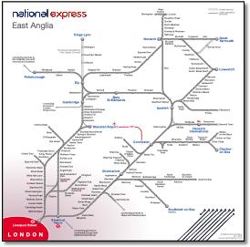
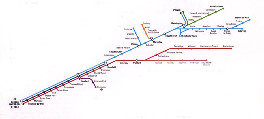
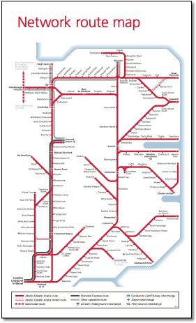
This map designed by FWT for the previous franchise holder 'One' is now used by National Express.
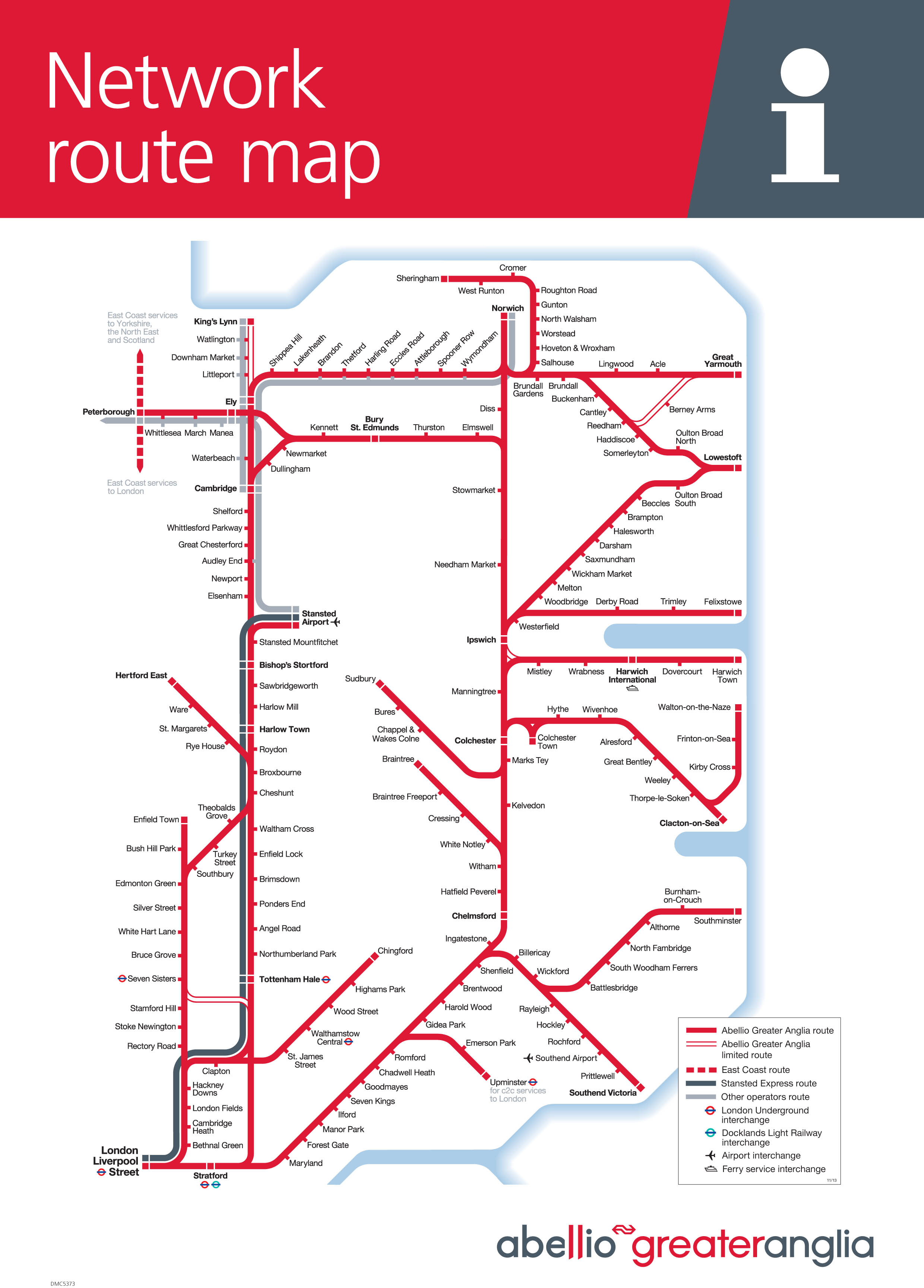
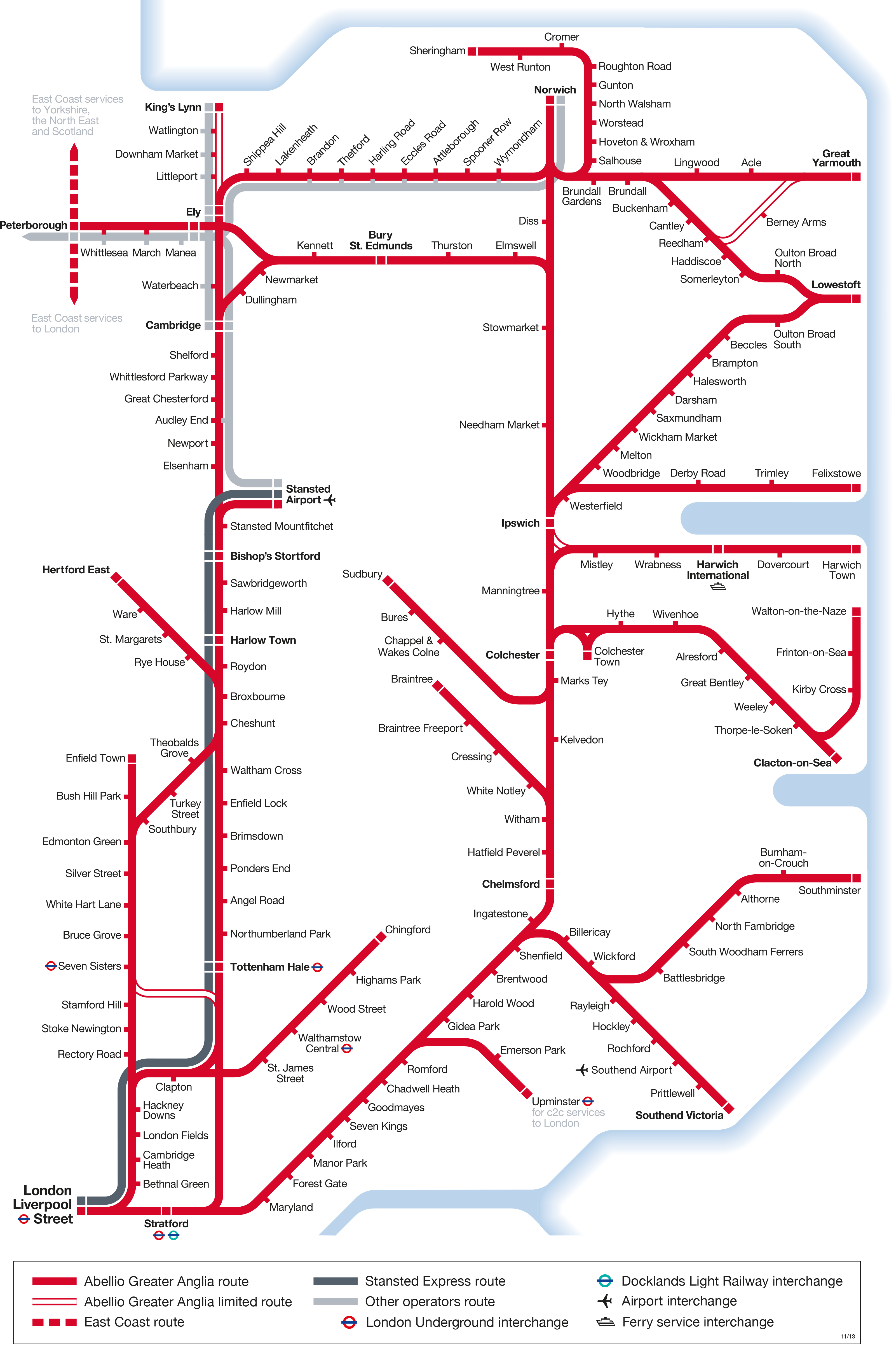
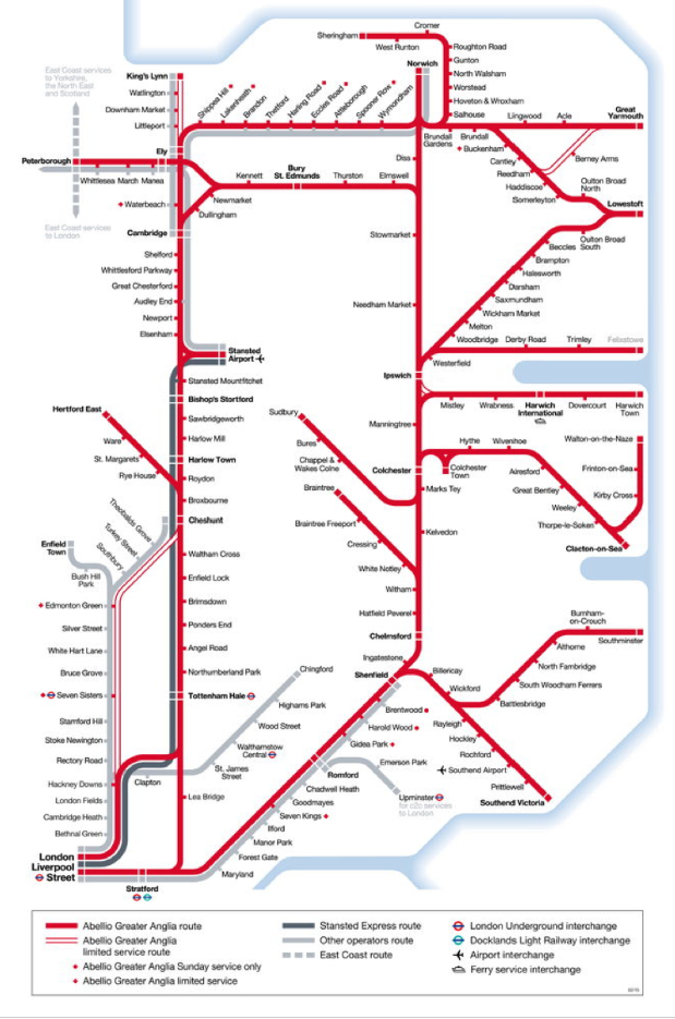
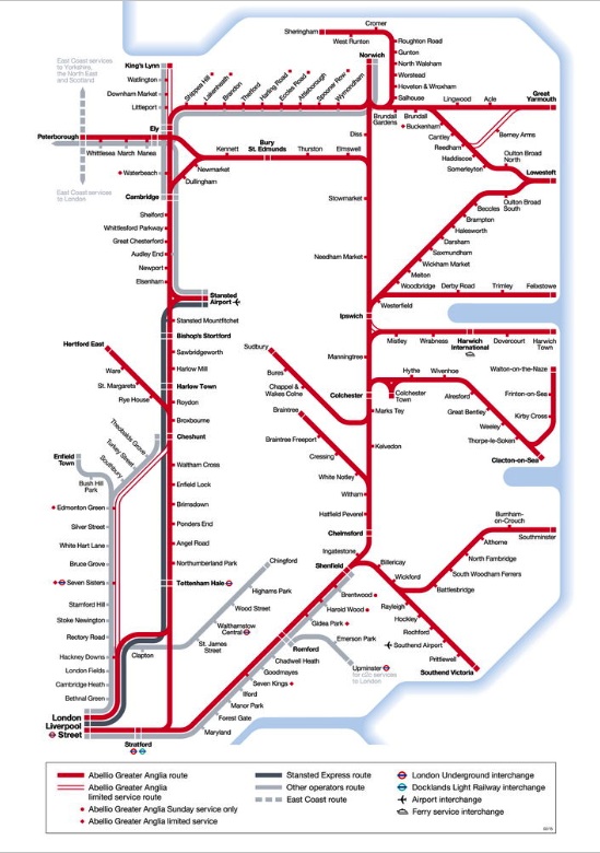
• All lines lead to London, yet London too small, nay invisble, in the bottom left of the page.
• Norwich too high creating unnecessary bends on Bittern line to Sheringham - line loops around itself in a most unlikely manner.
• Lack of effort by the designer on the Ely-Norwich line with the only angled station captions on the map.
• Doesn't show station reversal in Cromer although it does at Colchester Town (although slightly different situation).
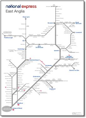
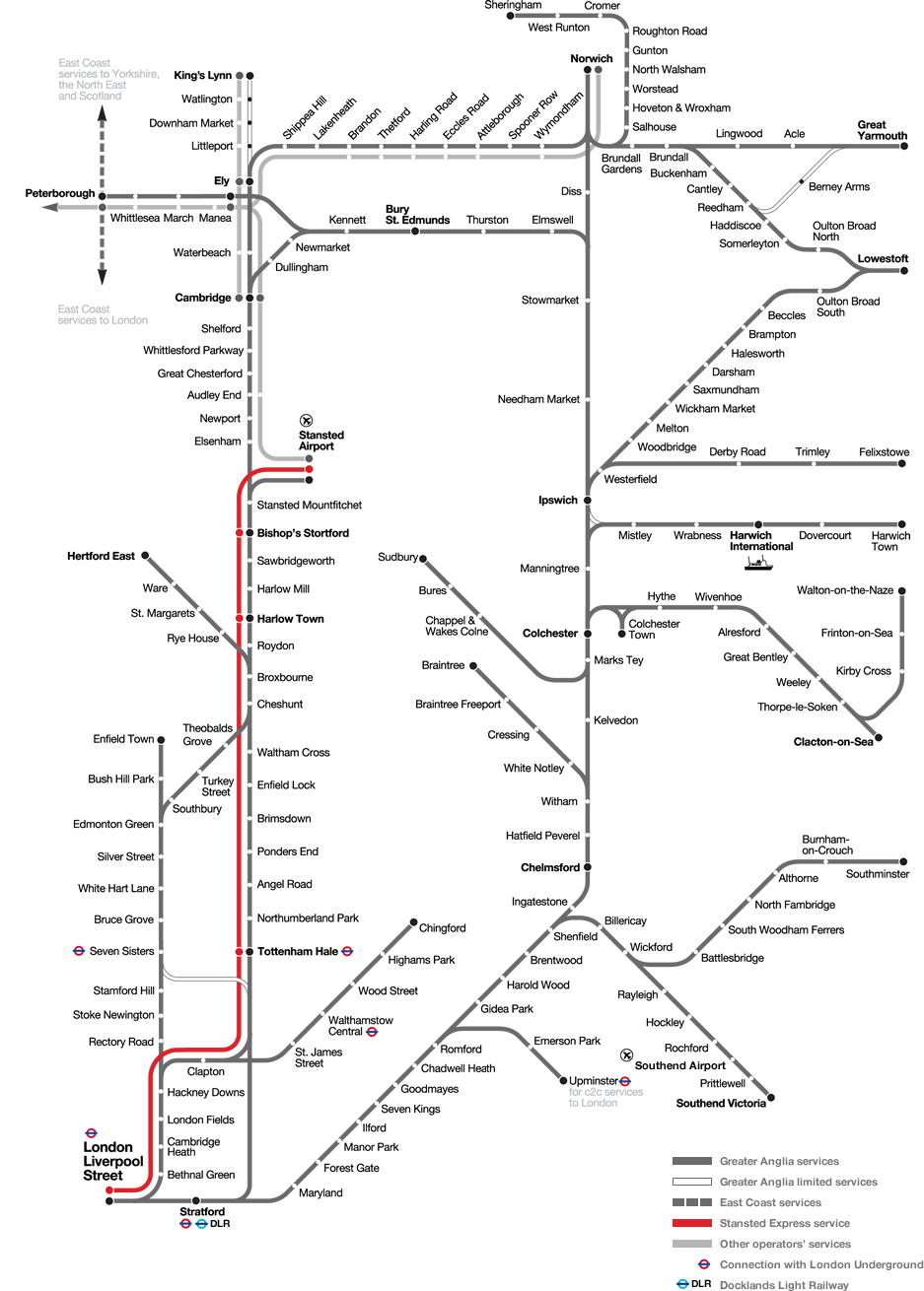
• Shame Ely couldn't be better represented rather than show it as two stations. This has meant that when the 'one' map was adapted (or not adapted) for the new NatEx website, Ely is wrongly positioned (see left).
• Daft geographic distortion on Walton-on-Naze branch and incredibly elongated Sudbury branch. Bury St Edmunds line too high up - Haughley Junction to Ipswich elongated.
• Harwich International is shown at the inland end of the estuary.
• Station name alignment has changed from being centred (eg Bury St Edmunds and Harwich International) to being oddly flush left (even Great Yarmouth).
Network outline
East Anglia train rail map
Map87Dicon
Network outline   Network outline
East Anglia train rail map
Network outline
Network outline
East Anglia train rail map Network outline   East Anglia train rail map
East Anglia train rail map
Network outline
East Anglia train rail map
Network outline
One East Anglia train rail map
item4a1 item4a item4a item4a2b item4a2b item4a2b item4a1 item4a1 item4a1b item4a2a1 item4a2a1 item4a2a1 item4a1b item4a1b