|
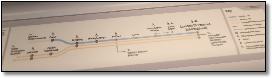
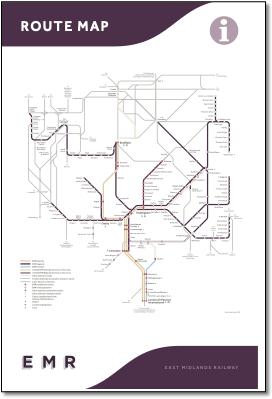
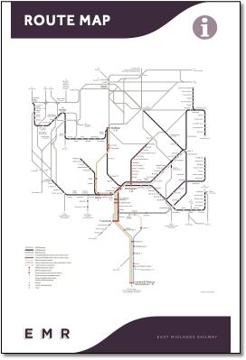
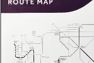
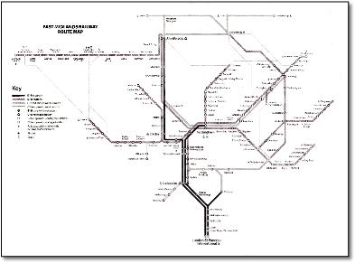
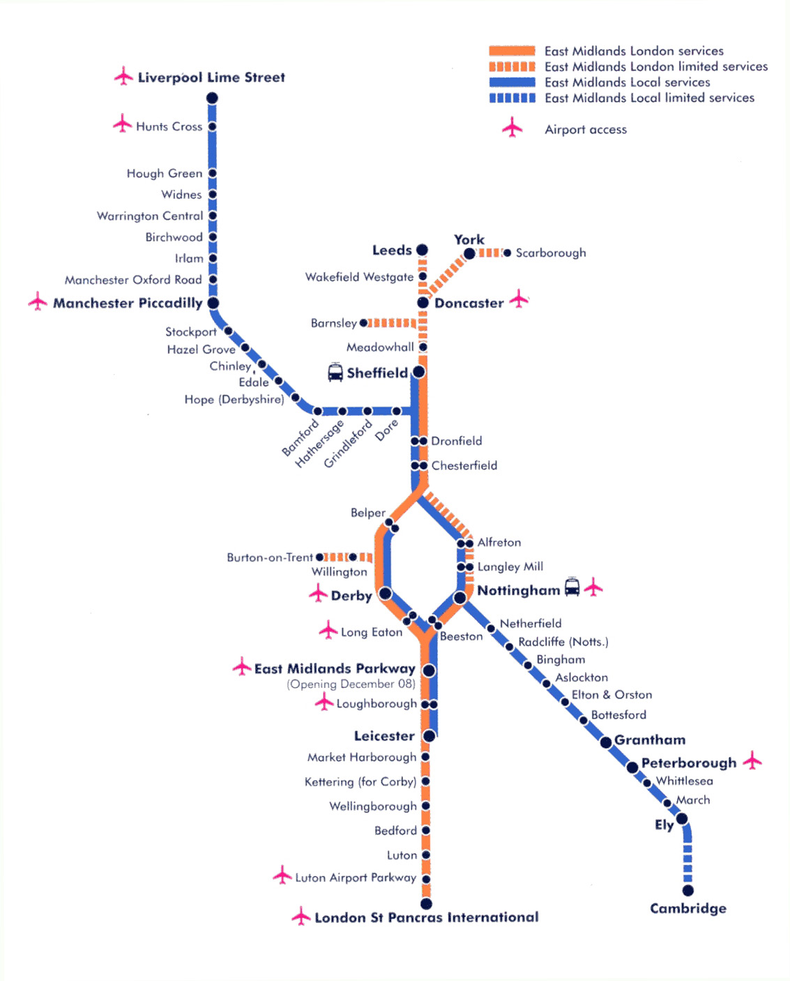
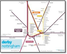
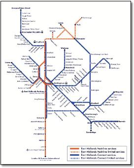
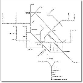
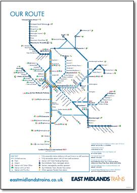
- Disappointing new map of the East Midlands franchise from East Midlands Railway. The inelegant design doesn't show the St Pancras spine as a high speed route and doesn't differentiate between regional and local routes. The dark colours tend to make the schematic map 'grubby' in appearance rather than exciting, an invitation to explore. One would hope for a design theme to emerge, for example with symmetrically repeating arms at Kettering and East Midlands Parkway producing a repeating motif to give the map some form.
- • Oxford Road and Lime Street unnecessarily abbreviated to Rd and St;
- • Incorrect airport symbol at Manchester Piccadilly;
- • Bizarre loop at Sheffield;
- • Junctions are inconsistently shown with some geographically correct, some nodal (Lincoln, Nottingham), some wrong (Manchester Piccadilly);
- • Use of LT style dumbbell interconnectors causes confusion indicating interchange rather than same station calls. And they break through services, eg at Lincoln - there are trains that run through north - south; and at Grantham where trains run through east to west;
- • Strange grey lines, rather bendy, not described in legend. The Crewe-Manchester line must be the route via the Manchester Airport stub reversal, not shown. You cannot use the WCML between Stoke-on-Trent and Manchester Piccadilly via Manchester Airport. The East Coast main line (direct and fast between Doncaster and Peterborough) is very awkward particularly around Newark. And why is it shown using the EMR through Newark but is shown parallel to EMR between Grantham and Peterborough?
- • Why are Burton-on-Trent and Hinckley (why not Nuneaton or Birmingham) routes shown as 'other operator services only'? Strange expression, the 'only' is not necessary. And there are plenty of other connecting services not shown, for example Congleton and Shrewsbury;
- • Parallel lines usually imply different services on the same route, but Nottingham to Burton Joyce / Radcliffe are distinctly different routes;
- • Skegness and Norwich routes could be lined up - no sense of how far east Norwich is;
- • What happens at Wakefield, which way do trains run? What happens at Doncaster, do trains run from Sheffield to York?
- • Is it really necessary to show stations that rarely see a train, for example all those local stations between Manchester and Sheffield which only see one train a day in each direction?
- • No title or logo.
|
|
|
|
 |
|
|
|
 |
|
|
|
|
 |
|
|
 |
|
|
|
|
|
 |
|
|
|
|
|
 |
|
|
|
|
|
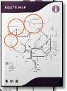
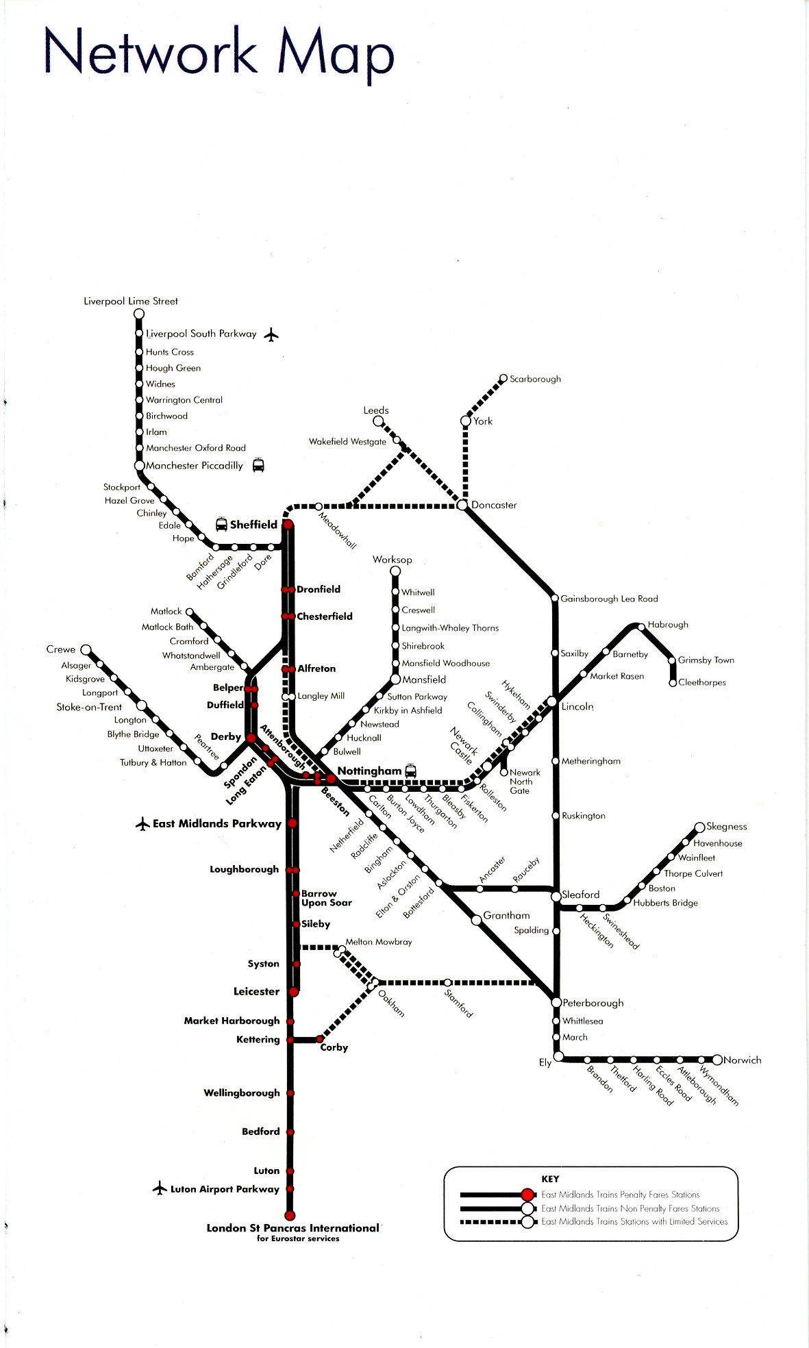
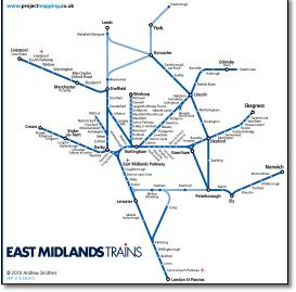
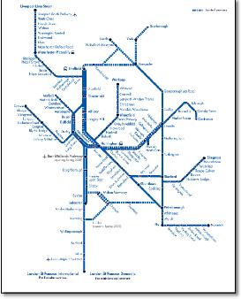
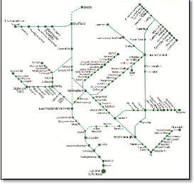
- • Three distinct service types identified in colour matching EMT timetables
- • Only 6 angled captions.
|
|
|
|
|
|
 |
|
|
|
|
 |
|
|
|
 |
|
|
 |
|
|
|
 |
|
|
|
|
|
|
|
 |
|
|
|
|
|
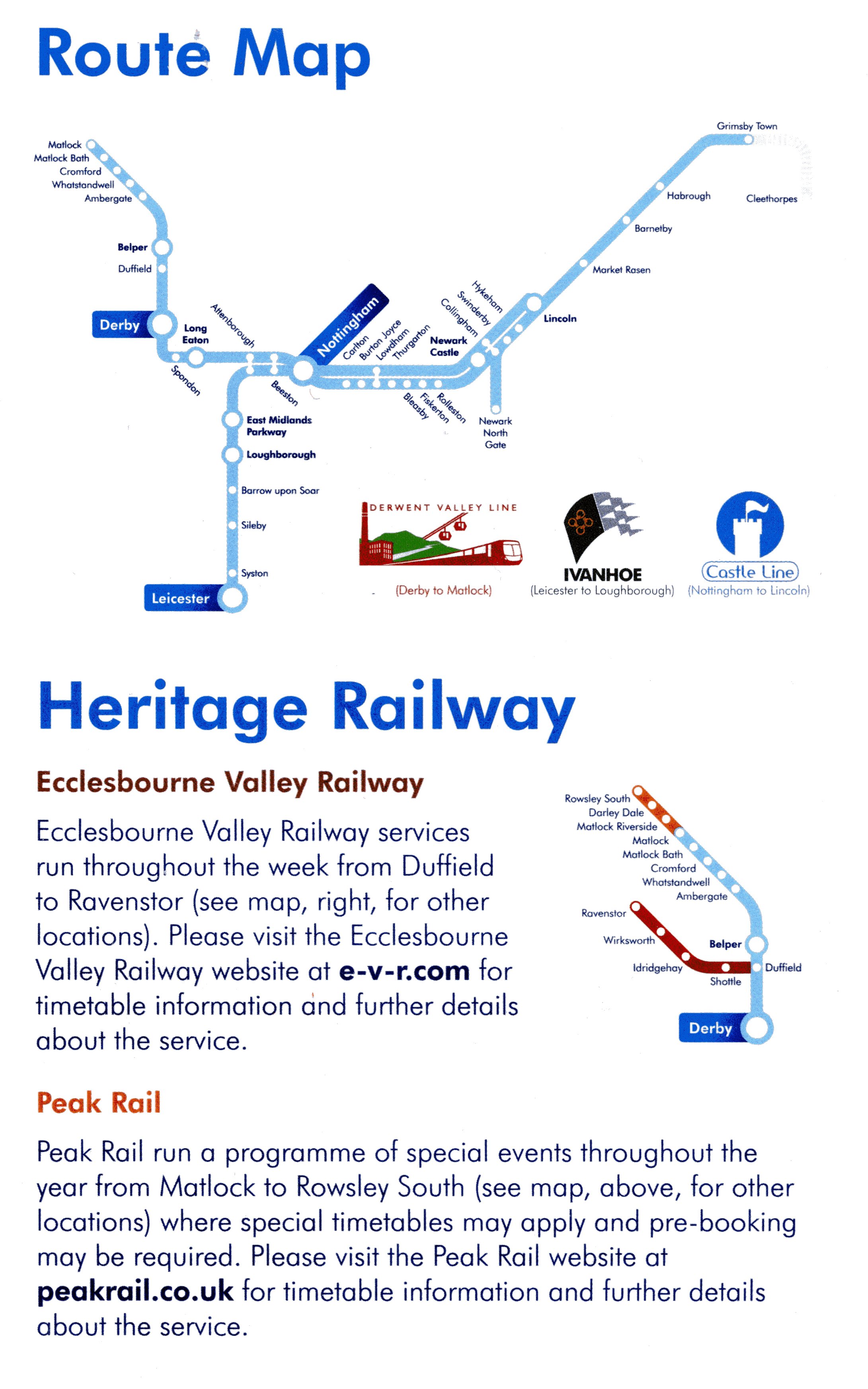
- • Grantham - Ancaster curve shown.
- • Liverpool - Norwich service local stations (in Hope Valley and East Anglia) at which only one train a day stops (approximately) not shown.
- • Only 10 angled captions.
|
|
|
|
 |
|
|
|
|
|
 |
|
|
|
|
 |
|
|
|
 |
|
|
|
|
|
 |
|
|
|
|
|
 |
|
|
|
 |
|
|
|
|
|
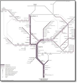
- Shame about that limp wrist over there between Habrough and Cleethorpes.
- 'London St Pancras International' - rather a long station title? Adding the over-long word 'International' after airport stations and every stop on High Speed One is a nuisance.
|
|
|
|
|
|
 |
|
|
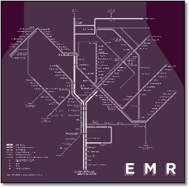
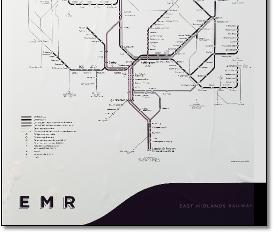
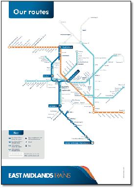
- Interestingly EMT have gone back to an octolinear design. Perhaps the previous adventurous curvy one was too much!
|
|
|
|
|
|
 |
|
|
|
|
|
 |
|
|
|
 |
|
|
|
|
|
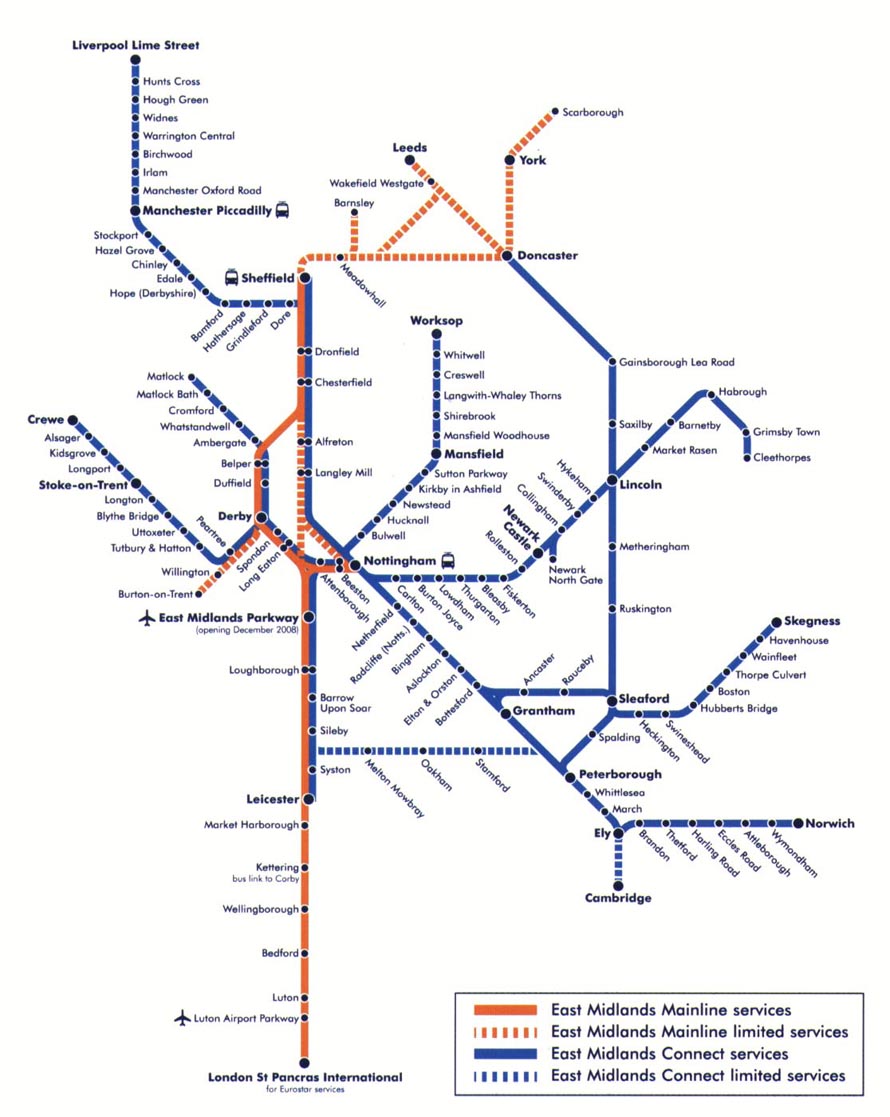
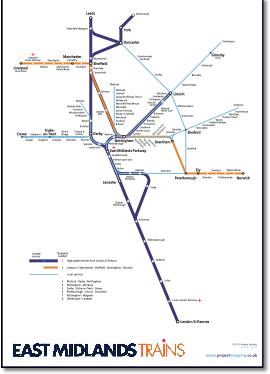
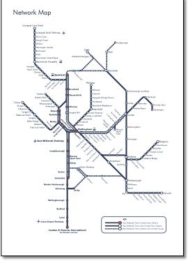
- John Simpson emailed me to say that the EMT map didn't match its timetable. This got me looking, where the following problems were unearthed...
- • Grantham - Ancaster curve not shown.
- • Some maps say St Pancras International and some say St Pancras Domestic.
- • Limited service hatching around Nottingham makes no sense when it runs parallel to a full service, making it difficult to see what goes on around Nottingham and Trent junctions. This hatching is historical and is left over from older maps where high speed services were separated from local services and in a different colour.
- • Route1TimetableDec09 map doesn't show direct Sheffield - Leeds route; or Scarborough in timetable; doesn't explain magenta numbers against station names.
- • Timetable numbers 1 - 9 have different file names (routes 1-4) so if you download them you don’t know which ones they are.
- • Liverpool - Norwich service shows local stations (in Hope Valley and East Anglia) at which only one train a day stops (approximately) . While the Cleethorpes service doesn't show all minor stations (but perhaps EMT don’t call at stations like Grimsby Docks and New Clee).
- • Matlock - Nottingham and Corby - Melton are the only services shown separately (although unclear what happens to Matlock trains at Nottingham).
- Corby trains run through to Derby as well I believe.
- • 37 angled captions.
|
|
|
|
|
|
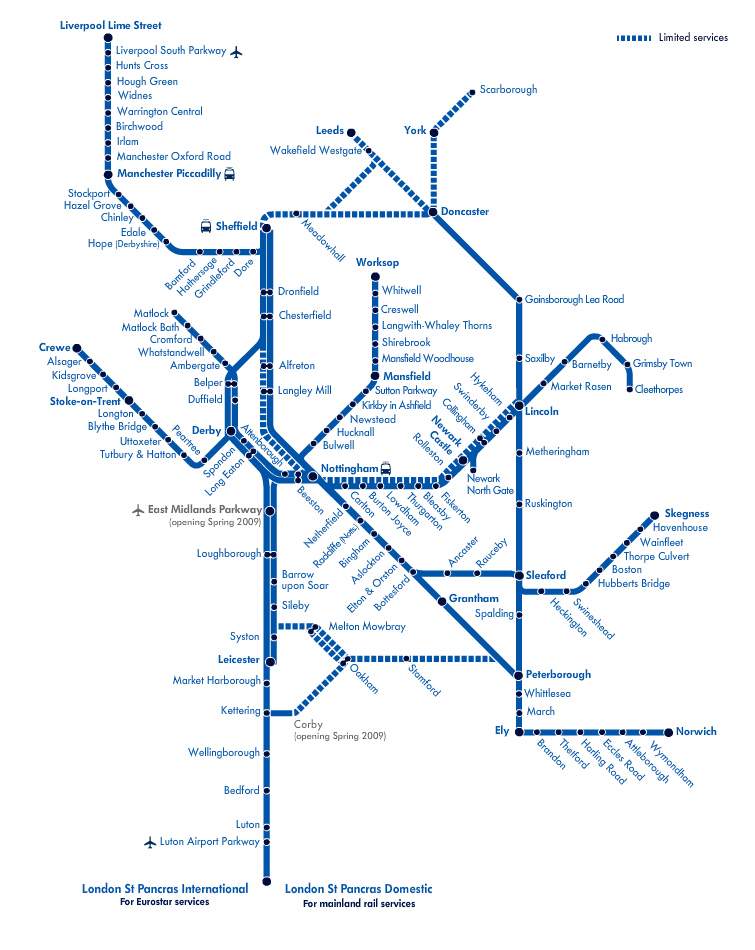
- Shame the central vertical isn't aligned.
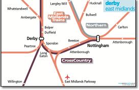
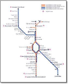
- No reference to name of airport served. Particularly Nottingham, Derby, Long Eaton, East Midlands Parkway and Loughborough which all presumably refer to East Midlands airport, but how should one choose one over the other? The leaflet suggests using Peterborough to change for another service to Stansted, why not Cambridge or Ely? And surprisingly, St Pancras is for Gatwick, not Heathrow, which doesn't feature in the list of seven international airports.
- The Liverpool arm has been unnecessarily extended making the map less efficient overall.
- And where is the Norwich line, or come to that, the many other missing EMT routes that can provide 'access' to airports?
- Why the distinction between London and 'local' services (when local includes the major Liverpool - East Anglia cross country route)? And surely the 'limited services' distinction taken from the main route map is of no benefit here?
- This map should show direct services to airport stations like, for example, the Manchester Airport map.
|
|
|
|
|
|
 |
|
|
|
|
|
 |
|
|
|
|
|
 |
|
|
|
|
|
|
|
|
 |
|
|
 |
|
|
 |
|
|
|
|
|
 |
|
|
|
|
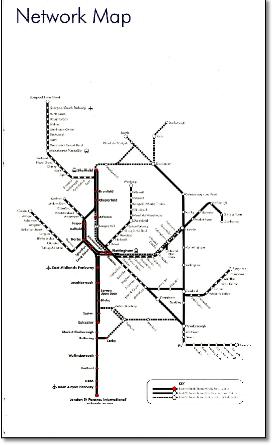
- Station names are too small and unreadable.
|
|
|
 |
|
|
|
|
|
 |
|
|
|
|
|
 |
|
|
|
|
|
|
 |
|
|
|
|
|
|
|
|
|
|
|
|
|
|
|
|
|
|
|
|
|
|
|
|
|
|
|
|
|
|
|
|