 |
||||||||||||||||
|
|||||
|
|
||||
|
 |
|
|||
|
|||||
|
|||||
|
|||||
 |
|||||||||||||||||||||||||||||||||||||||
 |
 |
||||||||||||||||||||||||||||||||||||||
 |
|||||||||||||||||||||||||||||||||||||||
 |
|||||||||||||||||||||||||||||||||||||||
1.jpg) |
|||||||||||||||||||||||||||||||||||||||
 |
|||||||||||||||||||||||||||||||||||||||
 |
|||||||||||||||||||||||||||||||||||||||
 |
|
||||||||||||||||||||||||||||||||||||||
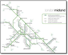
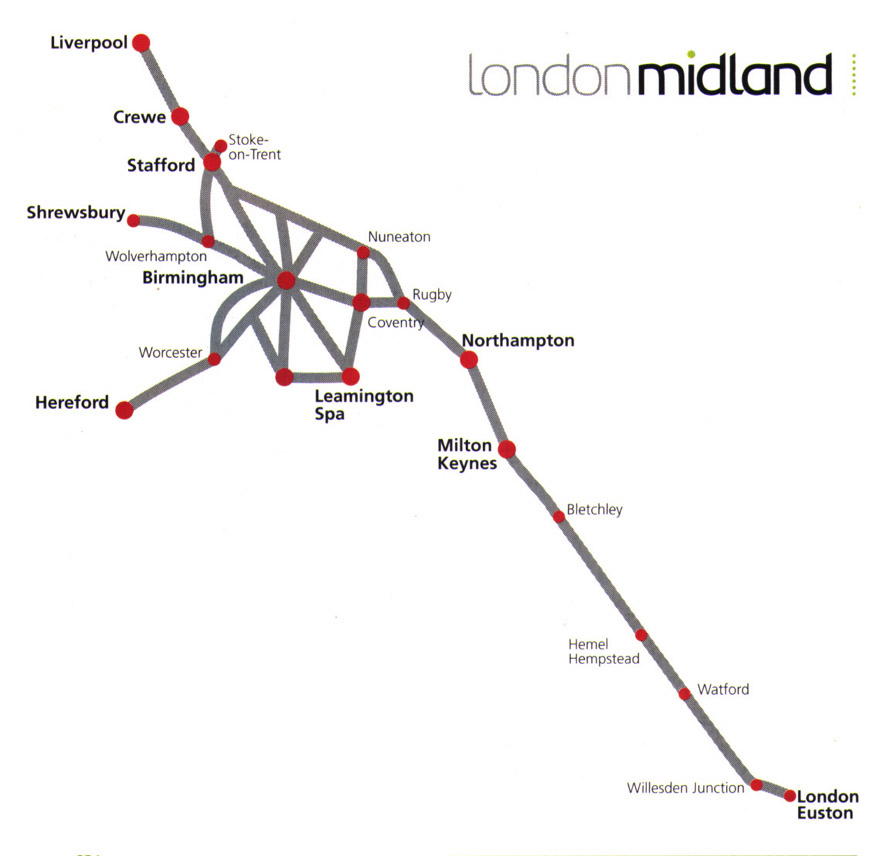
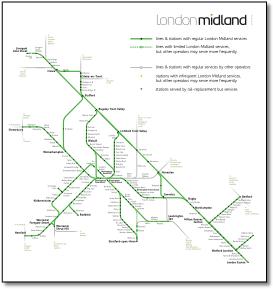
Drawn in the heat of the moment, put together by a Mandarin in Whitehall with a ruler. But it's all there! And a nice straight line Euston to Liverpool. It took two maps to do it but perhaps that right as maps that try to combine national and local routes often fail. |
|||||||||||||||||||||||||||||||||||||||
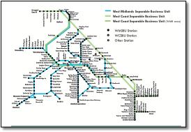
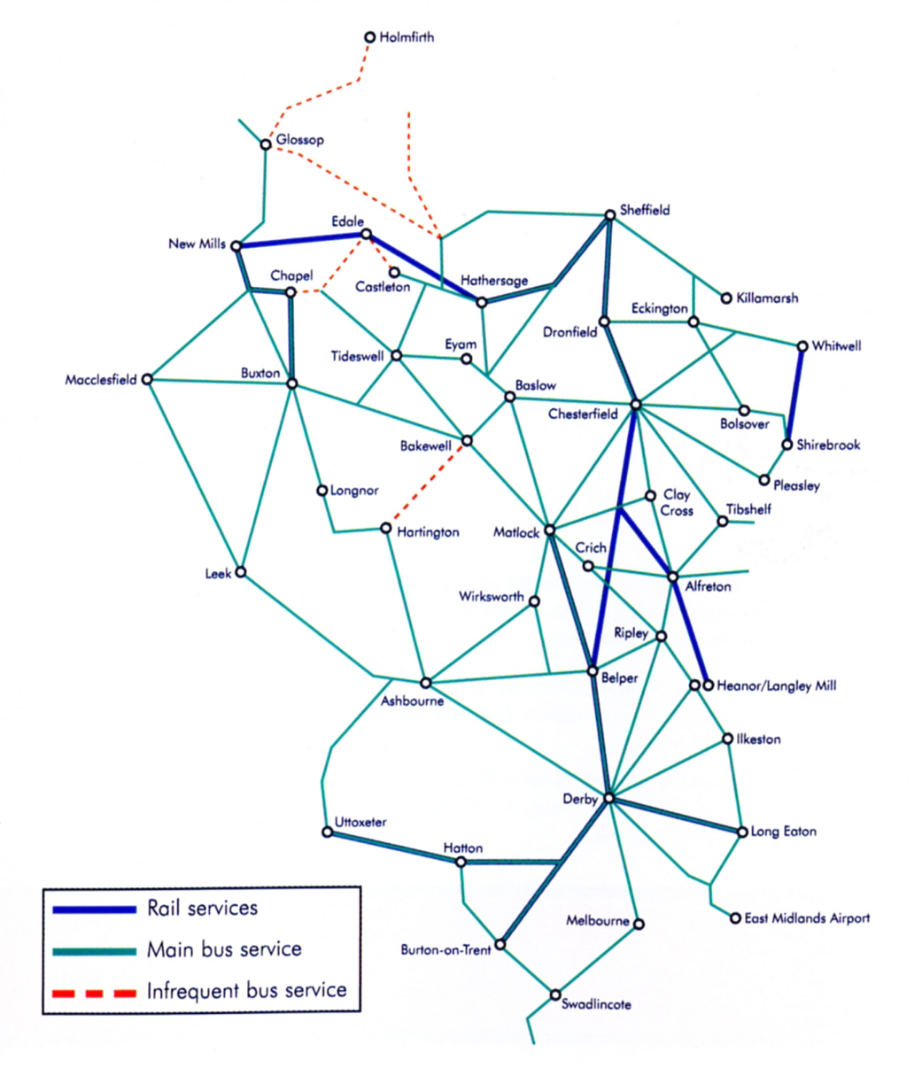
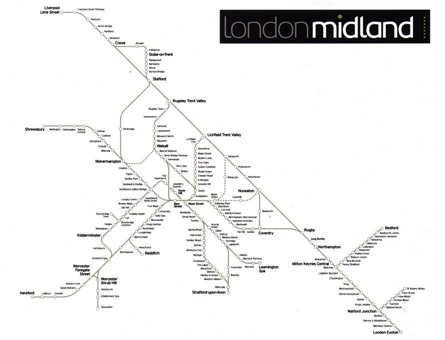
Completely different in style to the other two maps in the leaflet and a bit small to read. An infrequent bus service to nowhere? |
|||||||||||||||||||||||||||||||||||||||
 |
|||||||||||||||||||||||||||||||||||||||
 |
|||||||||||||||||||||||||||||||||||||||
 |
|||||||||||||||||||||||||||||||||||||||
 |
|||||||||||||||||||||||||||||||||||||||
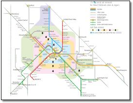
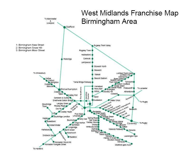
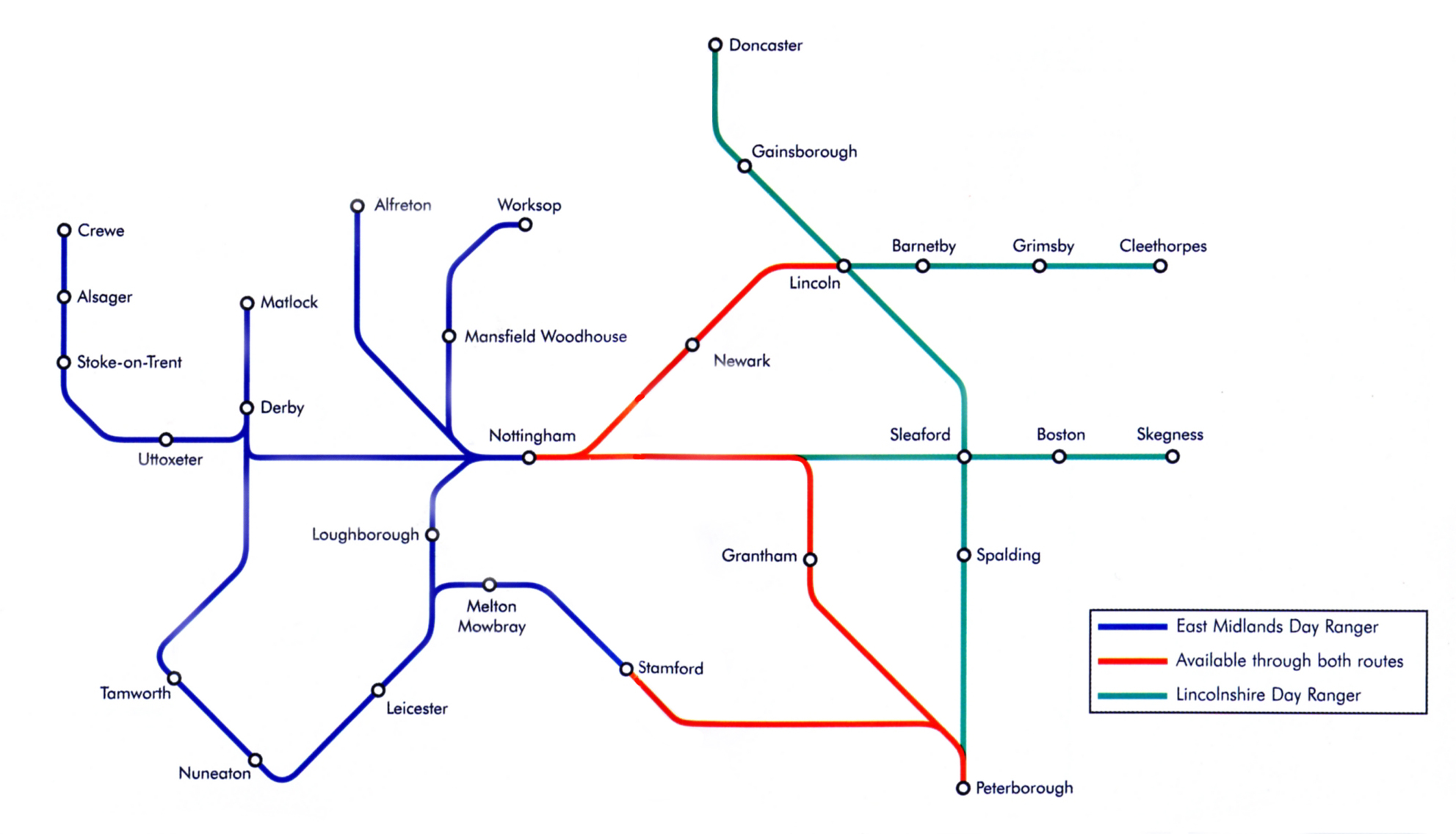
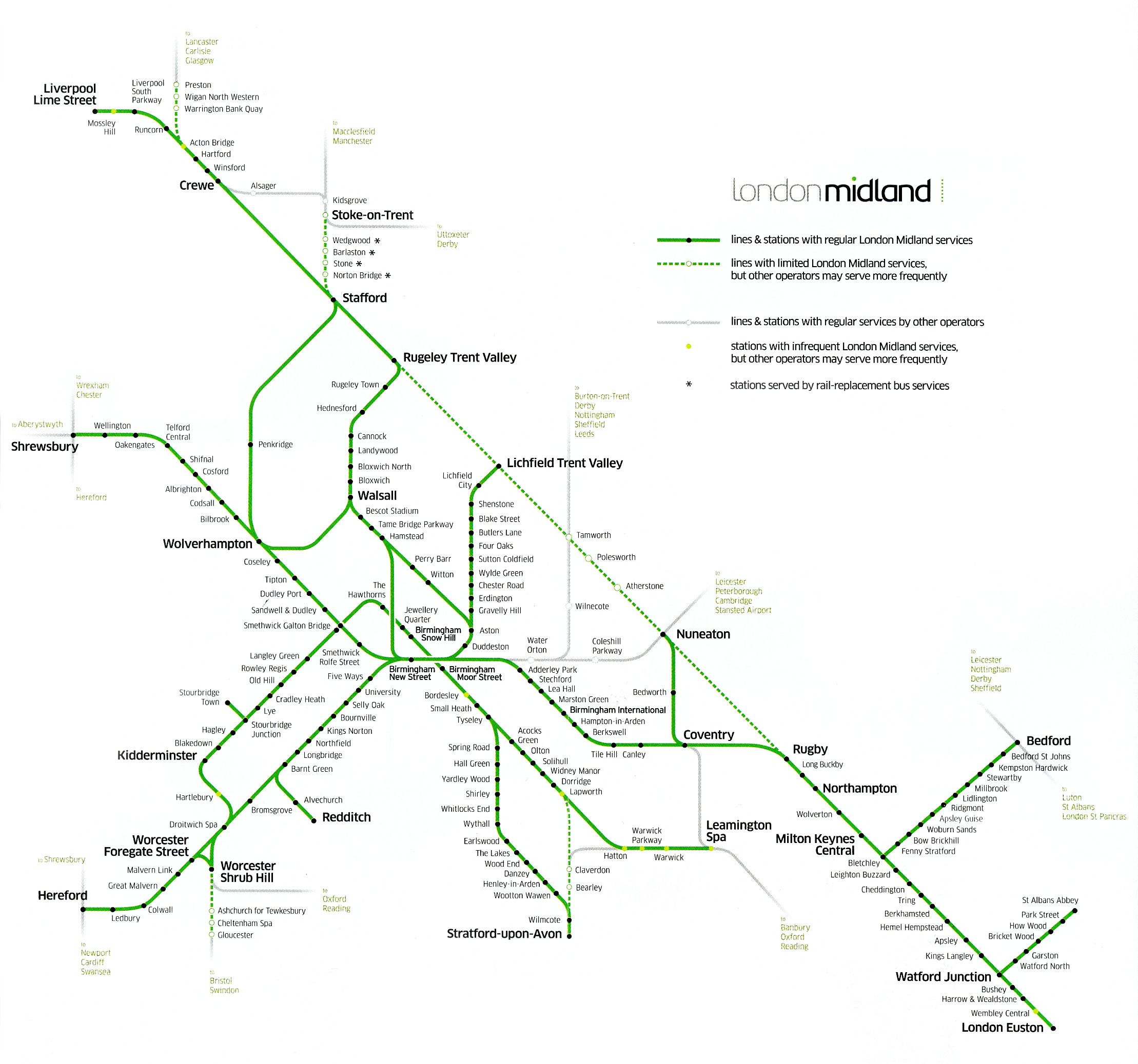
A bit of a mess really. |
|||||||||||||||||||||||||||||||||||||||
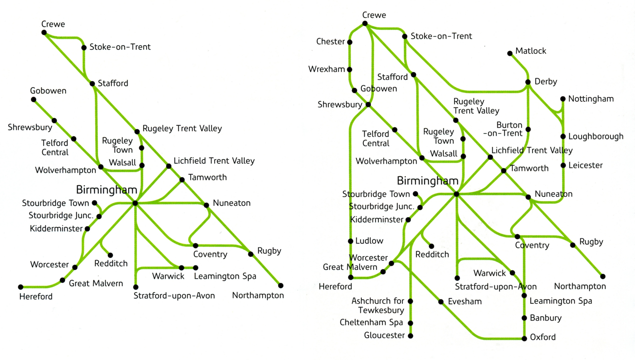
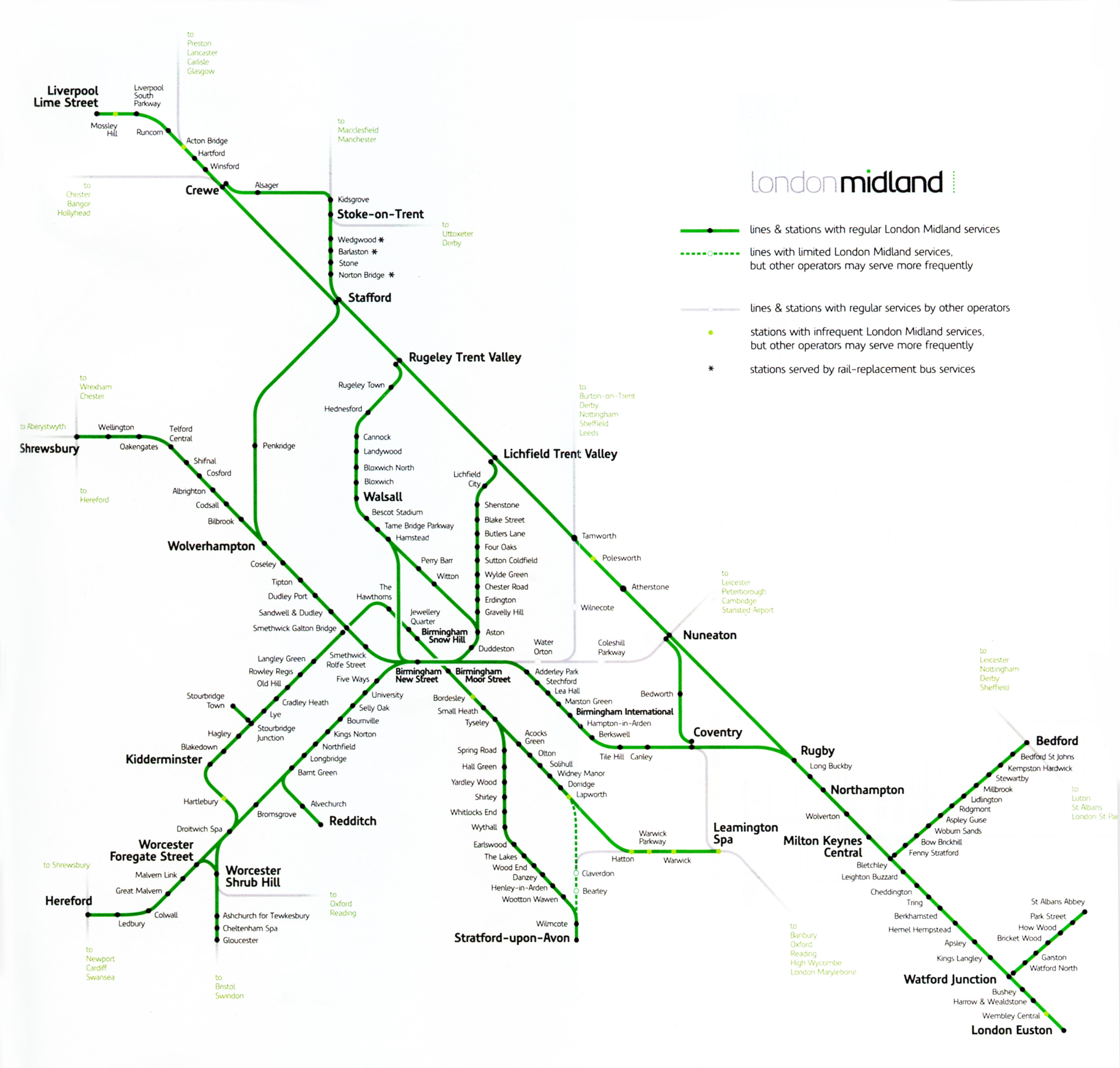
• Shows a line that doesn't exist between Stratford-on-Avon (uncaptioned) and the Birmingham-Bristol main line; |
|||||||||||||||||||||||||||||||||||||||
 |
|||||||||||||||||||||||||||||||||||||||
 |
|||||||||||||||||||||||||||||||||||||||
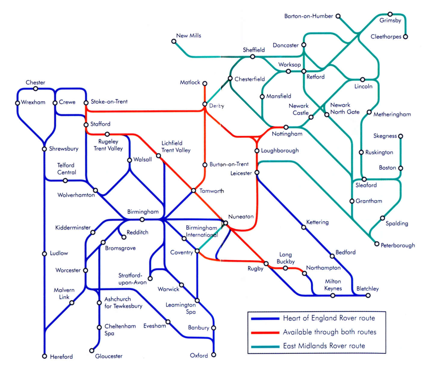
Why use a third colour for the overlapping routes rather than have parallel lines? |
|||||||||||||||||||||||||||||||||||||||
 |
 |
||||||||||||||||||||||||||||||||||||||
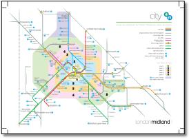
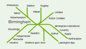
City outline. |
|||||||||||||||||||||||||||||||||||||||
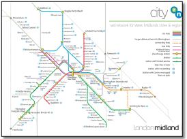
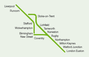
Express outline. Nice and simple but no Crewe, and Stafford a little unconnected. |
|||||||||||||||||||||||||||||||||||||||
 |
|||||||||||||||||||||||||||||||||||||||
Removes Wolverhampton-Walsall, adds North Staffordshire loop and Gloucester. |
|||||||||||||||||||||||||||||||||||||||
 |
||
Developed from cruder version below. |
||
 |
||
Quite stylish in light grey and has a straight line from London to Runcorn which anchors the whole thing. But that light grey does bring up readability issues and the map has a huge void top right - can a map take that amount of wasted space and get used in a practical way? And where is Birmingham - isn't that quite an important place? |
||