 |
|||||||||||||||
|
|||||
|
|
||||
|
 |
|
|||
|
|||||
|
|||||
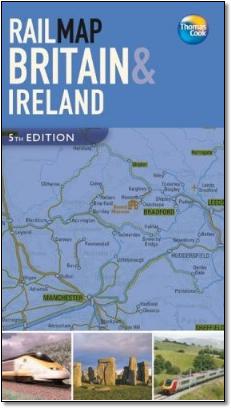
The Thomas Cook rail map is a poor piece of cartography as it is poorly drawn, fails to interpret complex networks, and despite the claim on its back cover, does not show all lines in the UK. The following headings describe these problems but are not exhaustive. Complete failure to interpret complex urban areas despite the large scale of the map The conurbations of Birmingham, Cardiff, Glasgow, Liverpool and Manchester are not explained or the detail shown, except London which is covered fully. This means for example Birmingham Snow Hill and the Jewelry line are not shown, Glasgow Central and Queen Street major termini not identified, etc, etc. The map gives the impression you can change in Birmingham between the Chiltern and Virgin routes, and between Cardiff Bay at the South Wales main line. Does not include 'all' railways For example, no Wrexham Central, no Dewsbury - Sowerby Bridge or Halifax - Huddersfield, no Stockton - Middlesbrough, no Paisley Canal, Ardrossan Harbour, Newcraighall or Larkhall branches. Wrong angles into stations/junctions For example: Littlehampton junctions shown wrongly, Exeter South Western line should enter from SE not NE, Durham coast line shown entering Newcastle from SE - should be SW, Fife Circle should lead south to Kircaldy, Dundee line at Perth should come in from the NE not SE TOCs not always accurate For example: Southern runs to Reigate, Virgin Cross Country does run Guildford - Redhill Unusual station selection For example: tiny Leigh in Kent, but no Castleford or Pontefract, Burnley multiple stations not shown, Falkirk multiple stations not shown, no Carstairs, Dumbarton, Dyce (even though the airport is shown), no Stalybridge Unclear junctions Not always clear if a junction is effected or not where lines of the same colour cross, for example: Strood/Rochester; Maidstone; Gloucester unclear, station is off mainline on Chepstow line; Falkirk Unclear stopping patterns Not always clear if station ovals covering lines is significant, for example: Virgin XC passes Gloucester (correct) but shows Virgin XC stopping at Mexborough but not Rotherham; map shows Virgin West Country stopping at local stations (ie Rugeley). Inconsistency For example: reversal shown at Morecambe and Cromer but not Swansea or Bere Alston Graphics Overlarge symbols for historic buildings etc., not sure if these are accessible from rail stations or not, inconsistent selection The selection of 'scenic routes' is subjective, for example: Shrewesbury - Chirk and western end of Newquay branch are not that great Generally poor alignment between stations and captions This is just a selection of the multiple problems occurring on this map, which is very disappointing from a publisher the likes of Thomas Cook as it does not stack up to the claims of its publicity, and is of little practical use as a travelers guide. |
||||
 |
||||
Much better. |
||||
 |
||||