 |
|||||||||||||||||
|
|||||
|
|
||||
|
 |
|
|||
|
|||||
|
|||||
|
|||||
 |
 |
 |
 |
 |
 |
 |
 |
|||||||||||||||||||||
1997 Privatisation of the railways Earlier versions not archived |
2006 Project Mapping website started 2007 First TOC version 2007 First diary 'outline' version |
2008 Map first appeared on National Rail Enquiries website 2009 First All Stations version |
With correct geographic entry/exit at junctions rather than stations as 'nodes' from 2020 |
|||||||||||||||||||||||||
 |
|||||||||||||||||||||||||||||||||
 |
|||||||||||||||||||||||||||||||||
 |
|||||||||||||||||||||||||||||||||
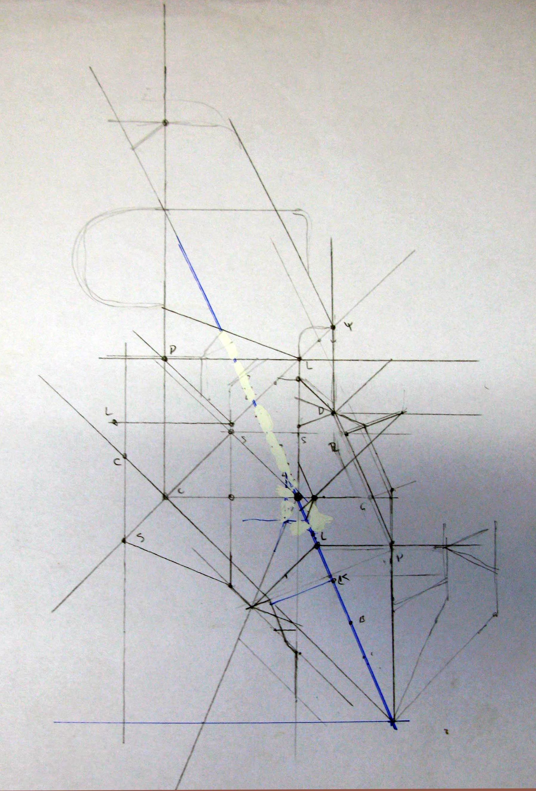
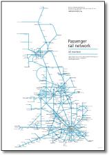
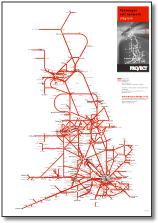
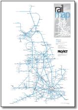
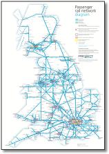
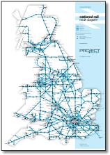
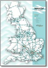
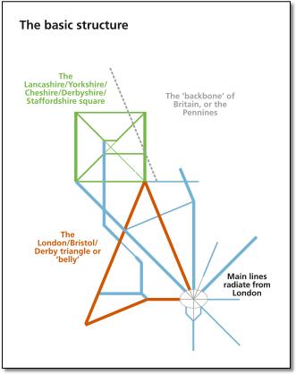
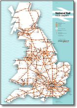
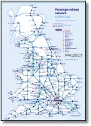
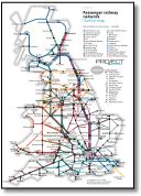
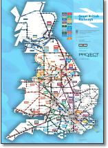
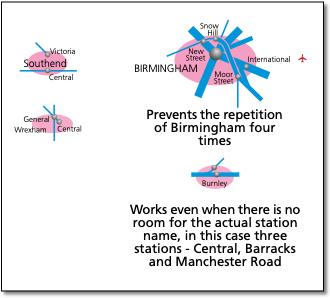
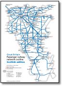
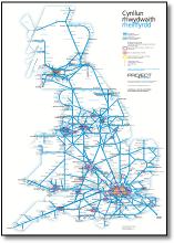
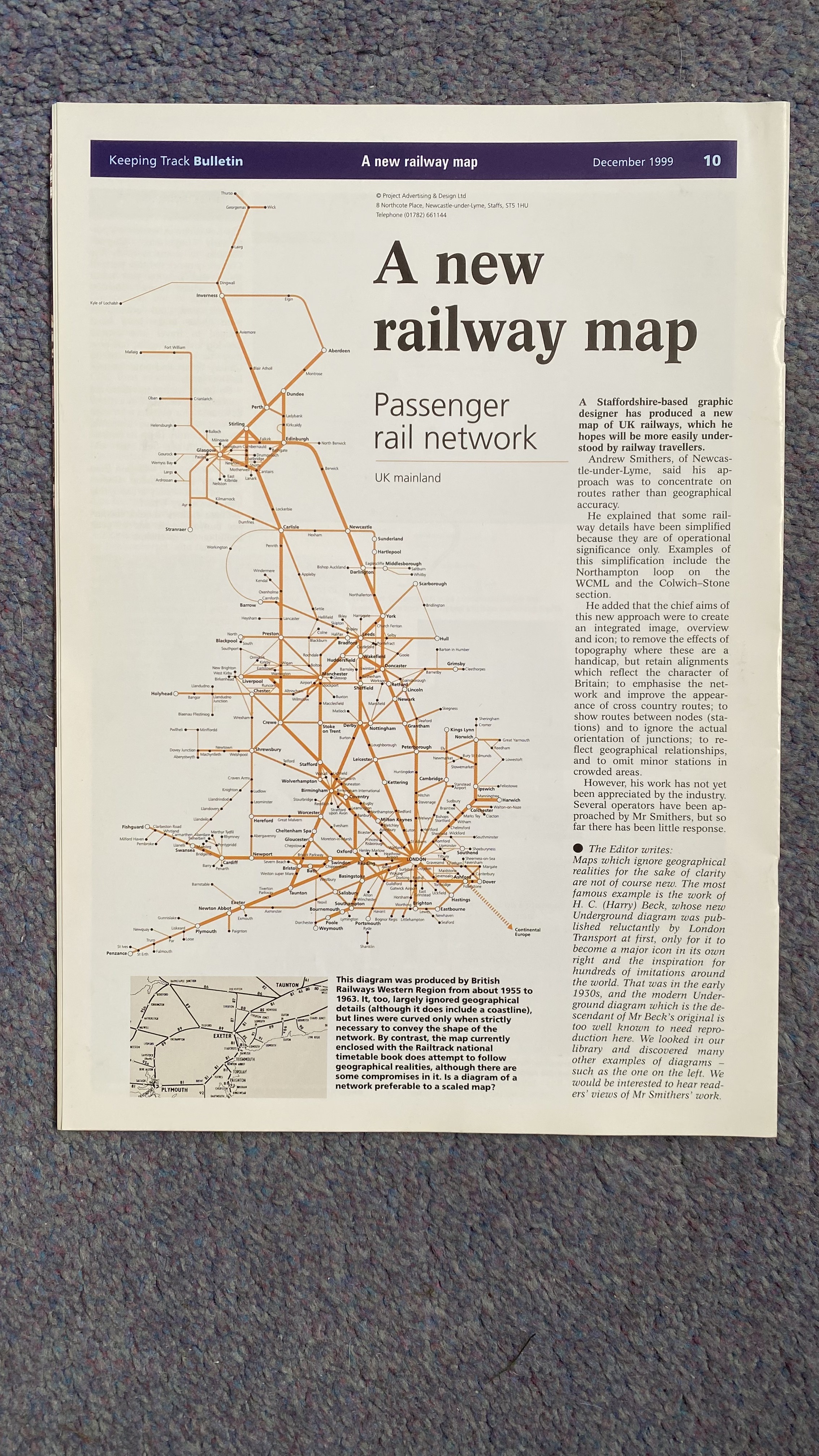
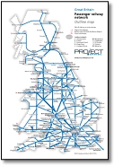
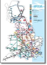
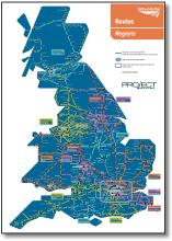
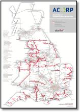
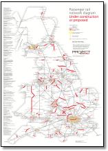
Features • Shows every passenger line in the UK (except around London) • Creates a clear impression of the network by showing the ‘bones’ of the system as straight lines with the minimum of direction changes • The point size and readability is the best of any map in its class with all captions horizontal and all London terminals named in position • Applies pre curvy version 30: Shows stations as nodes as the actual orientation of lines into junction stations isn't usually relevant to actual services; but shows where station reversal is required on plain line • Additionally shows geographical regions (ie North York Moors), route marketing names (Marsh Link), traditional route names (Trent Valley Line) and railway structures of interest (ie Forth Bridge) • Is the only map to solve the problem of repetitive names (by grouping multiple stations with oval boundaries) • Shows Hull trains and Grand Central’s Sunderland services as ‘principal’ routes The design criteria The aims and principles were to: • Create a map that would benefit public transport by creating an integrated image, overview and icon • Simplify routes as much as possible into straight lines, removing the effects of topography where these are a handicap, but retaining alignments that reflect the character of Britain • Show better the system as a network, particularly improving the appearance of cross country routes • Applies pre curvy version 30: Show routes between nodes (stations), as it is not possible to show services and the actual orientation of junctions isn't necessarily relevant to services • Reflect better the geographical relationships between countries, major conurbations and regions where possible • Particular attention to interpret complex networks (Cheshire/Lancashire, Yorkshire, Strathclyde) • Enough detail to ensure that users cannot make an impossible journey The solution The key to the solution was the establishment of a grid to simplify the complex Lancashire-Yorkshire network and a triangle for the critical London/Derby/Bristol ‘belly’. Adding a new 22.5° angle (even 11.25° occasionally) to the classic London Transport map system enabled all main lines to radiate from London and the East Coast and Midland main lines to follow and describe the slant of Britain. An indication of service frequency and quality is indicated by three line weights, and two levels of station importance were based on previous rail maps. Ideal size for the main map is A2, but it is still readable at A3. A smaller version (A4/A6) removes local services and provides an outline of the network ideal for diaries with stronger, larger, opened-out type. There is also a Community Rail Partnerships route diagram, Reopening Proposals and Network Rail Regions & Routes. Design points Showing places with multiple stations on different lines where it is undesirable to repeat the name of the location is a long-standing problem which has not been addressed consistently by other maps. For example, Birmingham New Street, Birmingham International, Birmingham Snow Hill and Birmingham Moor Street and now Birmingham Curzon Street - including such long titles in such a small area is very difficult and taxes the cartographers skills. This also applies to small locations, ie Burnley and Yeovil, and the largest of all - London. The solution, which must be consistent is as follows. The oval shape sums up the shape of all British towns and cities, it’s the shape of London and Glasgow and their circular underground lines. The conurbation name and station captions can also extend over the edge without confusion. The oval adds a bit more colour to the map. Overall, they give a good impression of the built-up areas of the country and explain the railways direct march towards them. The priority in the design was to keep the main lines as straight as possible, the ‘bones’ of the network, such that you could see the main lines when the map is viewed from a distance. This has meant the station names sometimes have to fall across lines (not allowed on the LU map because of dark line colours but occurring on the ATOC map) but this is always avoided unless strictly necessary. This means that you can clearly understand the underlying structure of the network, with regional lines linking at a secondary level and finally local lines filling the gaps or radiating from their respective cities. Bad routes on the ground due to geography, politics or history that have been straightened include Sheffield-Leeds, Exeter-Plymouth and Stafford-Stoke; curves that have been kept as they describe the shape of the country are Berwick and Huntly. The point size in relation to the overall map size is the largest of any map in its class with all captions horizontal and London terminals named in position. The map is the perfect combination of geometry and geography. |
 |
||||||||||||||||||||||||||||||||
 |
|||||||||||||||||||||||||||||||||
 |
|||||||||||||||||||||||||||||||||
 |
|||||||||||||||||||||||||||||||||
 |
|||||||||||||||||||||||||||||||||
 |
|||||||||||||||||||||||||||||||||
 |
|||||||||||||||||||||||||||||||||
 |
|||||||||||||||||||||||||||||||||
 |
|||||||||||||||||||||||||||||||||
 |
|||||||||||||||||||||||||||||||||
 |
|||||||||||||||||||||||||||||||||
 |
|||||||||||||||||||||||||||||||||
 |
|||||||||||||||||||||||||||||||||
 |
|||||||||||||||||||||||||||||||||
 |
|||||||||||||||||||||||||||||||||